Al Ain International Airport
Appearance
Al-Ain International Airport مَطَار ٱلْعَيْن ٱلدَُوَلِِي (in Arabic) | |||||||||||
|---|---|---|---|---|---|---|---|---|---|---|---|
 | |||||||||||
 | |||||||||||
| Summary | |||||||||||
| Airport type | Public | ||||||||||
| Operator | Abu Dhabi Airports Company | ||||||||||
| Serves | Al Ain | ||||||||||
| Opened | 31 March 1994 | ||||||||||
| Time zone | UAE Standard Time (UTC+04:00) | ||||||||||
| Elevation AMSL | 866 ft / 264 m | ||||||||||
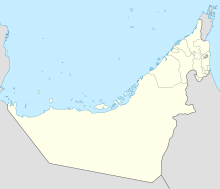
| Coordinates | 24°15′42″N 055°36′33″E / 24.26167°N 55.60917°E | ||||||||||
| Map | |||||||||||
 | |||||||||||
| Runways | |||||||||||
| |||||||||||
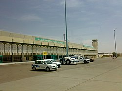
Al Ain International Airport (IATA: AAN, ICAO: OMAL) (Arabic: مَطَار ٱلْعَيْن ٱلدَُوَلِِي, transliterated: Maṭār Al-ʿAyn Ad-Duwalī) is an airport located 8 nautical miles (15 km; 9.2 mi) west-northwest[1] of Al Ain in the Eastern Region of the Emirate of Abu Dhabi, the United Arab Emirates. It was opened on 31 March 1994. It is the fifth busiest airport in the UAE.[2]
Airlines and destinations
[edit]| Airlines | Destinations |
|---|---|
| Air India Express | Kozhikode |
| Ariana Afghan Airlines | Khost |
| Nile Air | Cairo |
| Pakistan International Airlines | Islamabad |
Accidents and incidents
[edit]- On 27 February 2011, a Grumman 21T eight seater aircraft crashed shortly after takeoff, killing four on board.[3]
See also
[edit]References
[edit]- ^ a b "UAE AIP". Archived from the original on 30 December 2013. (login required)
- ^ "Largest airports and airlines in the United Arab Emirates". Worlddata.info. Retrieved 11 April 2024.
- ^ "Four Americans dead in plane crash". Eturbonews. 28 February 2011. Retrieved 28 February 2011.

